Search Results for: “Staffordshire”
UK Maps Collection


A collection of over 100 maps covering England, Scotland, Ireland and Wales. These high resolution maps can show you how place-names and counties differed from the present day. Contains various printable maps showing towns, counties, and countries in the UK from as early as 1660. More Info
Product Code: GRD36
Can't find what you're looking for? Try using our filter system to narrow down your search.
Available through our sister site GenFair
Old Parish Churches of Staffordshire & the West Midlands
By Mike Salter. This series of publications describes all the features of interest to be seen in the parish churches and chapels of ease of the English counties, dating from the Saxon period to the 1890s. Each volume contains a detailled gazetteer and is well illustrated with photographs, plans and drawings. 76 pages (A5)
Staffordshire 1842 Pigot Directory
113 pages on mini-CD from fiche images filmed from the original book, .pdf reader required. Published by SFHG & Parish Register Transcription Society.
Papist Lists in Lichfield Diocese 1767
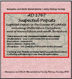
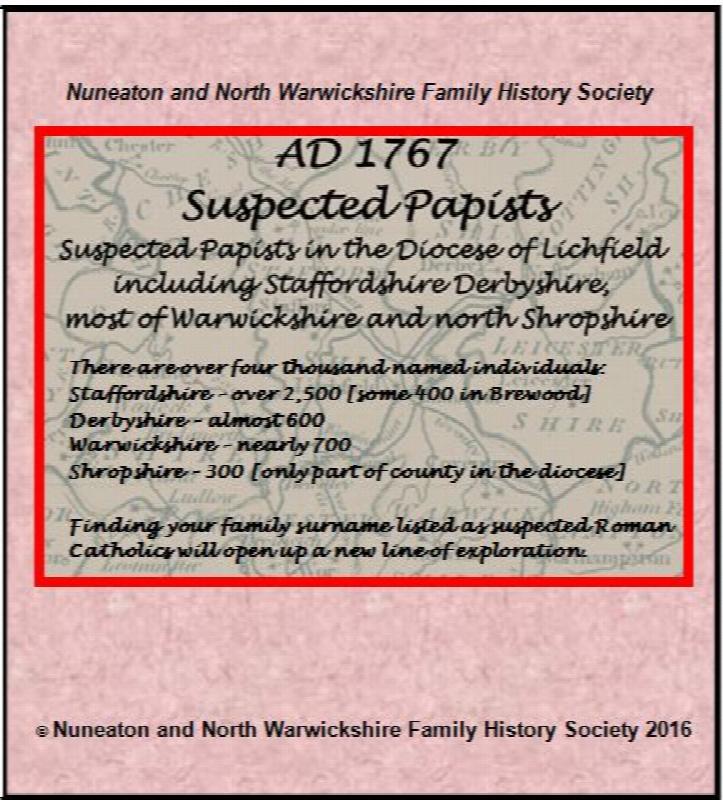
Suspected papists in Staffordshire, Derbyshire, Warwickshire & Shropshire indexed from the originals in the deposited records for Lichfield diocese, now held at Stafford Record Office.
The Bishops' Registers of Confirmations in the Midland and London Districts of the Catholic Church in England

The Midland register covers 1768-1811 and 1816. The Midland District comprised the counties of Derbyshire, Huntingdonshire, Leicestershire, Lincolnshire, Norfolk, Northamptonshire, Nottinghamshire, Oxfordshire, Shropshire, Staffordshire, Suffolk, Warwickshire and Worcestershire. Includes an index to names, 265 pages The London Register covers 1826-1837 and 1843. The London District was comprised ...More Info