Search Results for: “Buckinghamshire”
UK Maps Collection


A collection of over 100 maps covering England, Scotland, Ireland and Wales. These high resolution maps can show you how place-names and counties differed from the present day. Contains various printable maps showing towns, counties, and countries in the UK from as early as 1660. More Info
Product Code: GRD36
Can't find what you're looking for? Try using our filter system to narrow down your search.
Available through our sister site GenFair
The Chilterns in 1748: An Account by Pehr Kalm, Visitor from Finland, translated and edited by W.R.Mead (2nd edition, 2017)
Pehr Kalm, a native of Finland, was the favourite disciple of Karl Linnaeus. In 1748 he spent five months in England staying at Little Gaddesden to see the farming activities of the area. Whilst here he kept a diary which has been translated by the author thus giving us an invaluable account of the agriculture of the Chilterns in the mid 18th century (165 pages, illustrated).
Winslow in 1556. The Survey of the Manor. By David Noy
The manor of Winslow, including Granborough and Little Horwood, was surveyed in 1556. Putting together the survey and evidence from other historical documents, David Noy develops a panorama of Winslow's economic, social and religious life in the mid-16th century. This book includes the survey itself, translated from its original Latin and published for the first time.
Bucks Convicts Sent to Australia 1789-1865: Eve McLaughlin
Names of convicts, offences, sentences, court, when transported to Australia, ship name, destination; ship list..
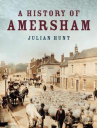
War Memorials And War Graves Vol 10 - Amersham, Chesham area
Covering: Amersham, Ashley Green, Chenies, Chesham, Cholesbury, Chesham, Chesham Bois, Coleshill, Hawridge, Latimer, Ley hill, Penn, Penn Street, St Leonards all memorials