Discover our brand-new premium archival sleeves, upgrade RootsMagic with 20% off and catch the new WDYTYA episode with Zoe Ball.
S&N Genealogy Supplies
__hi__
There’s plenty to get excited about this bank holiday weekend!
We're delighted to introduce our brand-new range of A4 Premium Sleeves.
These sleeves use an ultra-transparent archival material with welded edges for extra security. For a limited time you can save 10% across the range, as well as on our popular Premium Binders, until 31st May. Whether you’re organising family certificates, photographs, postcards or treasured documents, now is the perfect time to upgrade your archive in style.
Keep your treasured family history documents safe and beautifully presented with our premium sleeves. Each sleeve is crafted from acid-free, PVC-free materials and contains no chemical softeners, making them ideal for long-term, safe storage of delicate items without risk of yellowing or damage. The Black sleeves are double-sided with pockets on both sides of the black backing, so you can display items back to back.
What makes these different to our standard sleeves? Our Premium range of sleeves are made from an ultra-transparent material which offers crystal-clear viewing, and the edges are welded with a single strip which offers a more secure pocket for your items.
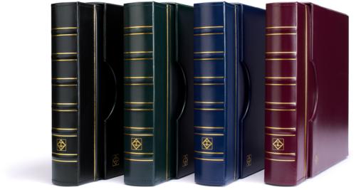
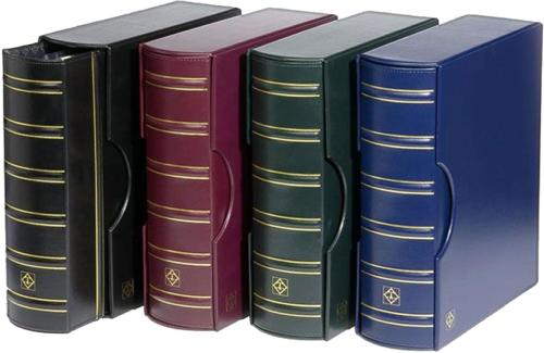
We are also offering 10% off our Grande Premium Library Binder Album Sets! Crafted in the finest bookbinder’s tradition with a luxurious leatherette cover, our sets include a matching slipcase to ensure your research is protected from dust, light, and damage, keeping your records safe for generations.
In Zoe Ball’s episode of Who Do You Think You Are?, the broadcaster set out with a few questions from her children about Vikings, pirates and Romans. What she found instead was far more human: women holding homes together, miners following work, children living through poverty, and relatives whose names had almost vanished until records brought them back into view. Airing Tuesday 26th May, read about Zoe's episode now!