Search Results for: “Dorset”
UK Maps Collection


A collection of over 100 maps covering England, Scotland, Ireland and Wales. These high resolution maps can show you how place-names and counties differed from the present day. Contains various printable maps showing towns, counties, and countries in the UK from as early as 1660. More Info
Product Code: GRD36
Can't find what you're looking for? Try using our filter system to narrow down your search.
Available through our sister site GenFair
MEMORIALS OF OLD DORSET
Although the title of this book suggests that it deals with memorials, it is more of a history book covering various locations and buildings that are important to the historical and cultural heritage of Dorset. Some of the subjects covered are; • Churches of Dorset • Isle of Purbeck • Dorchester • Memorial Brasses in Dorset • Ford Abbey • Bridport • Plus m...More Info
A Study of Churches in Dorset
Over 300 Dorset parish churches photographed and described with brief histories together with information on the location of their records. The area covered is the historical county of Dorset, so excludes churches in Bournemouth and Christchurch which were previously part of Hampshire. In each case there is at least one photograph of the exterior of the church, and as far as possible photographs o...More Info
Dorset Quarter Sessions Order Book 1625-1638, edited by Terry Hearing and Sarah Bridges

Consists of 642 numbered folios plus some additional sheets. Because of the limited survival of such records, this book is the best source for the history of local government in Dorset. Published by the Dorset Record Society. 503 pages. Hardback.
East Dorset "Superfamily"
Contains the names of more than 6200 individuals, taken from the Society's collection of pedigrees and family trees, who have been combined into one 'superfamily' using birth and marriage records. Details are given of names, dates, locations and relationships, produced using the Generations program. It also provides a Family Tree Maker version and a file in GEDCOM format for transfer into other pr...More Info
DORSET TUDOR MUSTER ROLLS 1539, 1542 AND 1569* Edited by T. L. Stoate
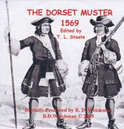
A searchable transcript of all three years of muster for the county of Dorset