Search Results for: “Lincolnshire”
UK Maps Collection


A collection of over 100 maps covering England, Scotland, Ireland and Wales. These high resolution maps can show you how place-names and counties differed from the present day. Contains various printable maps showing towns, counties, and countries in the UK from as early as 1660. More Info
Product Code: GRD36
Can't find what you're looking for? Try using our filter system to narrow down your search.
Available through our sister site GenFair
Lincolnshire Parish Register Burials 1813-1900 Volume 1
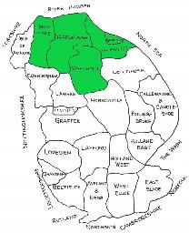
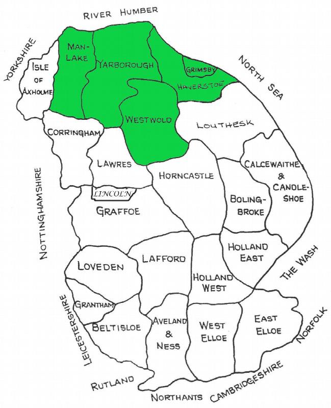
Deaneries included are Grimsby & Cleethorpes, Haverstoe, Manlake, Westwold, and Yarborough. In PDF format
Lincolnshire Parish Register Burials 1813-1900 Volume 2
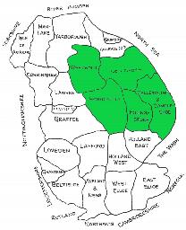
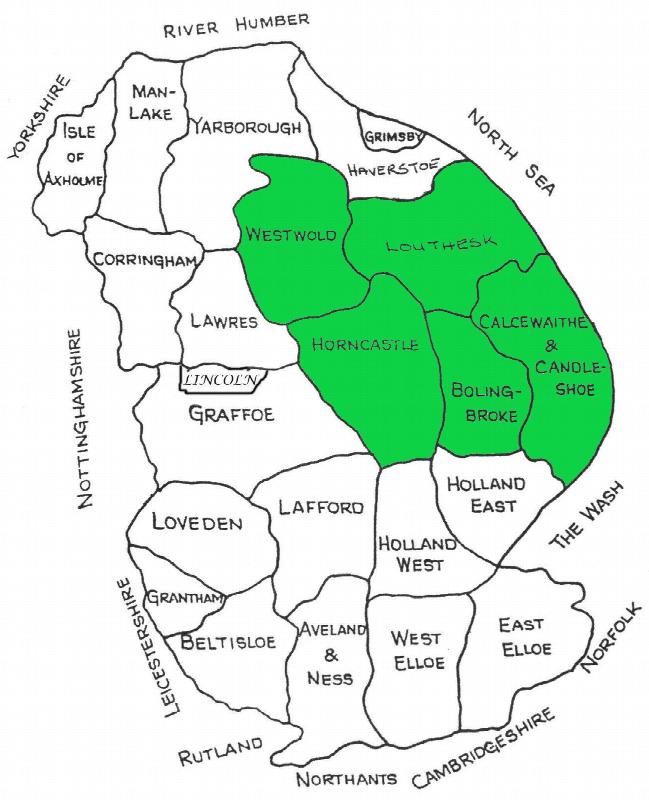
Deaneries included are Bolingbroke, Calcewaithe & Candleshoe, Horncastle and Louthesk. In PDF format
Lincolnshire Parish Register Burials 1813-1900 Volume 3

Deaneries included are Corringham, Graffoe, Lawres and Lincoln (Christianity) The date range 1813-1900, is approximate. In PDF format
Lincolnshire Wills (Canterbury Court 1653-1660)
Wills proved at the Prerogative Court of Canterbury. Extracted from the British Record Society - vols. 7 & 8. A4 size, 55 pages, a LFHS publication
Lincolnshire Nonconformists 1
Contains Dissenters' Certificates 1740-1852. Places of worship other than Church of England, were required to be licensed by the Bishop. The certificates state whose house or whose property could be used for worship. Nonconformist Marriages 1647-1845.These are mainly Quaker with dates of marriage ranging from 1647 to 1836. Baptist, seven marriages from The General Baptist Church, Killingholme 170...More Info