Search Results for: “Map Atlas”
Surname Atlas Version 1.20

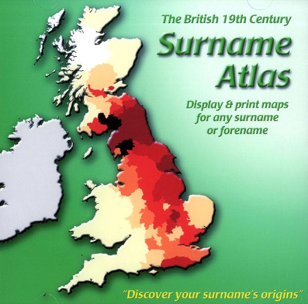
The 19th Century Surname Atlas for Great Britain displays and prints maps showing the concentrations for any surname or forename. The CD includes maps for all of the 400,000+ surnames that appear in the 1881 census and all of the forenames too. Print the maps at any scale and copy to the clipboard for pasting into printed documents or creating web graphics. Not suitable for Macintosh computers. Minimum requirements *Windows 10/8/7/Vista/XP/98 *CD-Rom/DVD-Rom drive (required for inst More Info
Product Code: SW1713
Can't find what you're looking for? Try using our filter system to narrow down your search.
Available through our sister site GenFair
An Historic Map of Wotton-under–Edge


This A4 size coloured map is based on the 1882 Ordnance Survey map of the town at 25 inches to the mile. The map has been annotated with information on some of the historic buildings, people and facts. As well as being of interest in itself it makes an ideal gift when visiting relatives and friends abroad.
Buckinghamshire Parish Map A3 size
Map for marking off places researched - ample room for name entry [sent in tube]
Chesham Town; Tithe Map 1844
map with plot numbers, with a booklet list and index of all househoilders and what they owned. [sent in tube]