1898 Royal Atlas of England and Wales (edited by J.G. Bartholomew)
£29.95
£14.95
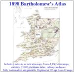
A complete series of topographical maps, physical and statistical charts, town plans, and index of 35,000 names (England and Wales - includes City street maps showing locations no longer in existence through development and bombing in World War II).
ISBN/EAN: 9781861500205
Download Filesize: 853.7 MiB
Find all our research resources for: England Wales
This is a heavy item so postage will be increased if it is to be shipped outside the UK.
Note: If you buy this item as part of an order containing items that do not have free postage you will be charged for postage at the appropriate rate for those items.
A complete series of topographical maps, physical and statistical charts, town plans, and index of 35,000 names (England and Wales - includes City street maps showing locations no longer in existence through development and bombing in World War II).
... I was able to clearly see every road, footpath and small hill. These maps are really detailed! The 1898 Bartholomew's Atlas is a valuable resource for anyone searching for ancestors' homes of that period. You can easily locate their addresses and then see the surroundings in which they lived.
Click the link(s) below to read reviews for this product:
1898 Bartholomew’s Atlas on CD-ROM


